
Maps. We are passionate about maps, we like to look at maps, and we love to create maps.
There are many options for creating maps: from using traditional desktop GIS software to using a web application for it. Geographic Information Systems (GIS) applications are ideal for analyzing, editing, and visualizing spatial data, as well as creating custom maps. However, using these tools requires learning, and the options they offer can be overwhelming.
But there’s good news. If we want to create custom maps, we don’t need to use a GIS-enabled application.

In this post, we’ll look at some simple alternatives that allow us to create our own custom maps online in a matter of seconds, and in many cases, without needing to register beforehand.
1. Mappin 
Mappin lets you create and download custom maps, with paid options if you want a more elaborate document, in an easy way with just 5 steps:
- Select the location.
- Add a pin.
- Select a style (the more elaborate ones cost between $2 and $3).
- Choose the design.
- Choose a border.

2. EZ Map
EZ Map advertises itself as a tool for creating maps in Google Maps and embedding them on your own website. This tool eliminates the hassle of dealing with Google Maps. We’ve already explained how to embed Google Maps on our blog.
EZ Map lets us select a map region to embed on our website and add various markers or controls to the web map. But what’s really interesting about this tool is the ability to use a wide variety of available themes based on Snazzy Maps.

To save the maps we must register.
3. GmapGIS
GmapGIS is a simple GIS application created in 2010 for everyday users (non-specialists) to view, create, and share data using Google Maps. The application is currently free to use.

We can draw lines and shapes, add labels and markers, and measure distances on the map. We can also add files in GeoJSON or ZIP shapefile format.
Once we’ve finished compiling the map, a shareable link is automatically generated. We can also choose whether to save the map in GeoJOSN or KML format, or view it in Google Earth .
4. MapChart
Mapchart.net lets us create custom maps of the world, Europe, America, Africa, the United States, or the United Kingdom with your choice of colors and descriptions.
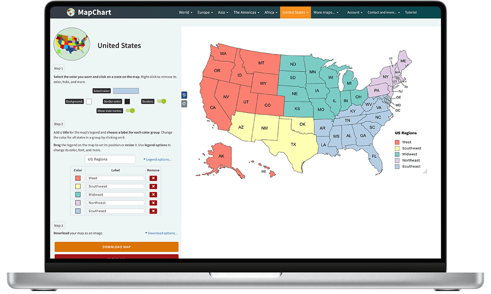
Mapchart offers a custom color scheme from a selection of user-friendly color palettes. The generated map is a high-resolution PNG image that can be used and embedded on a website for free. Highly recommended!
5. Mapcreator
Mapcreator is the mapping tool that lets you create high-quality branded maps fast and easy. With just a few clicks, you’ll have maps that match your professional image.
6. MapInSeconds.com
MapInSeconds is a tool that lets us convert spreadsheet data into maps.

It’s very intuitive to use. Simply copy the data from your Excel sheet and paste it into the application. As with the previous tool, you can choose a color palette to further customize the result. Once pasted, a map is automatically created that you can download in PPTX or PNG format. Plus, since it doesn’t require registration, creating a map really only takes seconds.
Note! You must have a column with the names of the regions (country, city, or province). It works simply, but sometimes it doesn’t read the regions correctly; it requires a little practice.
7. PixelMap Generator
PixelMap Generator is a fantastic tool for creating custom pixel maps.

In this post we tell you more about this alternative for creating custom maps.
8. Scribble Maps
Scribble Maps is a mapping tool that provides a convenient platform for drawing and sharing maps.

We can easily add custom images, place text and markers, draw shapes, calculate distances, save a map in PDF format, and much more.
We can also send maps to our friends or embed them on a website. The basic Scribble service is free, while Scribble Maps VIP (paid) allows us to import KML files, spreadsheets, and SHP files.
9. ZeeMaps |
ZeeMaps (We map your lists) allows us to design and publish interactive maps without any registration. The basic plan allows you to create maps with up to 100 views, share them with friends and co-workers, publish them in your website, create high resolution images, and so forth.
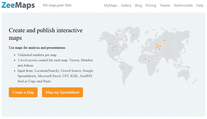
We can create maps from data from: Location (Search), Google Sheets, Microsoft Excel, CSV, KML, GeoRSS feed or by Copy and Paste.
Using ZeeMaps, you can place customizable markers, highlight countries, states, and cities, add video, audio, or sound clips, add customizable search fields to your map, create heat maps, make maps private, perform GeoSearch (searches that meet a field value and proximity criteria), plan trips, and finally export the map in PNG or PDF format and share it via URL.
10. KINDERKIEZ | Design your children’s neighborhood!
Through the Kinderkiez website you can design a map that looks like a children’s neighborhood.
- Move the map to find the perfect map section.
- zoom: The section can be scaled using the zoom function.
- rotate: The rotation function allows you to change the orientation.

Once the map has been created, we can order a rug or poster online, with pre-configured sizes.
Bonus: iimaps –The easiest way to make data maps.
The easiest way to map data in minutes, without programming or GIS experience, with a free but limited version.

Licenciado en Geografía. Máster en Sistemas de Información Geográfica. Consultor GIS desde el año 2004. En MappingGIS desde el año 2012 para ayudarte a impulsar tu perfil GIS y diferenciarte de la competencia. Echa un vistazo a todos nuestros cursos de SIG online.
Check out kmzmap.com. It’s free and has a lot of gis functions